Chongqing University - Faculty of Architecture and Urban Planning
NNSF study - 6 months
Instructor: Haoyan Wei
Year: 2015
Collaborators: Lu Li, Zili Pang
Today in China, there's a developing tendency of cities is to rebalance cities away from a dependence on cars by providing more diverse alternative traffic modes, to reduce the adverse ecological effects. Prioritizing walkability is one of the most critical approaches. There have already been multiple kinds of methods for quantitatively analyzing pedestrian network so far. However, whether we could measure and analyze the pedestrian network from a different perspective and in a different logic is the question this study attempts to answer. This study constructs a quantitative analysis model for the efficiency and choice of the pedestrian network morphology. This study takes the Daping area in Chongqing as the sampled object of study. After calculations of the sample pedestrian unit area with the model, a series of analysis is taken. As the results reflect, the complicated relations between efficiency and choice are not merely beneficial or contradictory, but highly relevant to the form of the pedestrian network itself.
This study is supported by the National Natural Science Foundation of China [Grant No. 51278503].
Introduction
Today in China, developing cities are facing an enormous need to improve environmental conservation, ecological maintenance, and social equity. One of the critical methods to reduce the adverse ecological effects of cities is to rebalance cities away from a dependence on cars by providing more diverse alternative traffic modes. As the most basic, most ancient and “greenest” mode of travel, walking should be prioritized by urban planners as the most appropriate choice of transportation. Prioritizing walkability also reflects the value of social equality and improves the health of the residents. However, under pressure from the environment, ecological conditions and the society, the current situation of the pedestrian network in China is deteriorating.
During the previous three decades, the problems aggravating the position of the pedestrian network are mainly reflected in the following two events happening in the cities: the original compact pedestrian network in the old urban area has been quickly destroyed during massive city development; the construction of the pedestrian network in the new districts has been severely neglected. In a word, the pedestrian network is severely fractured. There have already been multiple kinds of methods for quantitatively analyzing pedestrian network so far, such as space syntax, and several different calculation methods based on the GIS platform. Each of the methods has its areas of competency, which provided this study with great insights and references. However, whether we could measure and analyze the pedestrian network from a different perspective and in a different logic is the question this study attempts to answer.
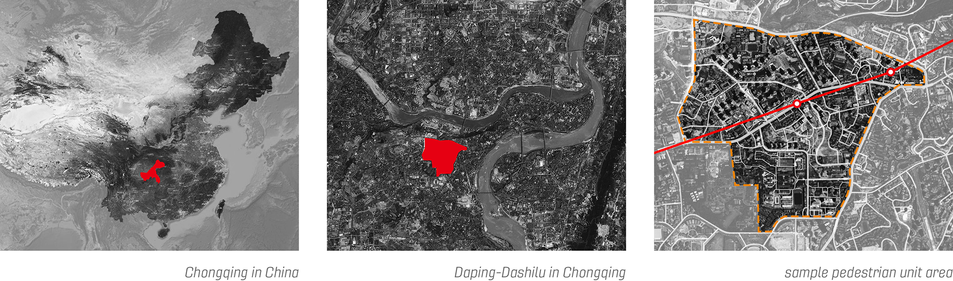
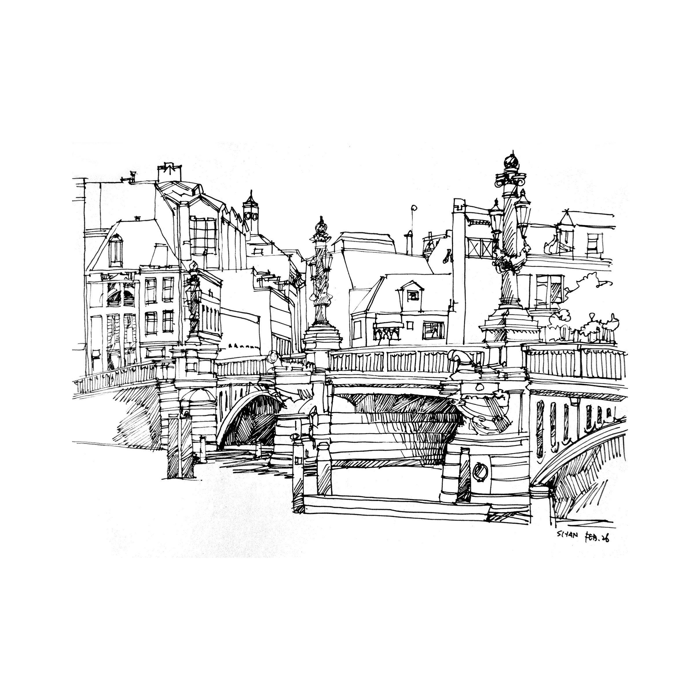
Chongqing is the most famous and most representative mountainous city in China, with a rolling horizon of hills and peaks where the Yangtze River and Jialing River meet, reflecting the typical natural morphological characteristics of a mountainous landscape city. The undulating terrain of the city accounts for the advanced development of the original pedestrian network, especially in the Yuzhong District. The streets are mostly parallel to the contour lines, while the walking paths are mainly perpendicular to the contour lines or level with them. However, during the past three decades, the original pedestrian network has undergone tremendous damage.
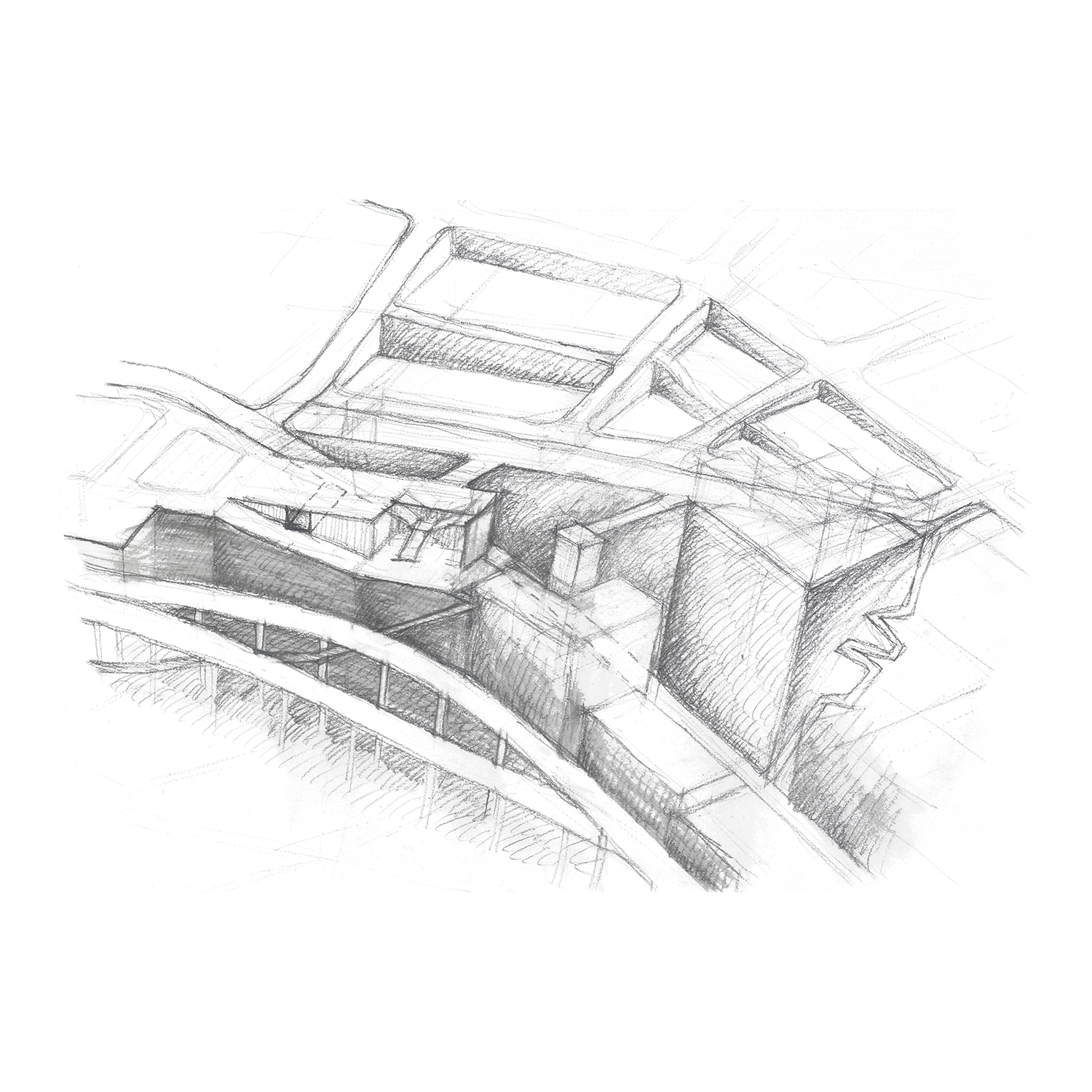
This study takes the Daping-Dashilu area in Yuzhong District as the sampled object of study, which is located in the Daping commercial zone of Yuzhong District, Chongqing, the area of which is approximately 2.05 sqkm.
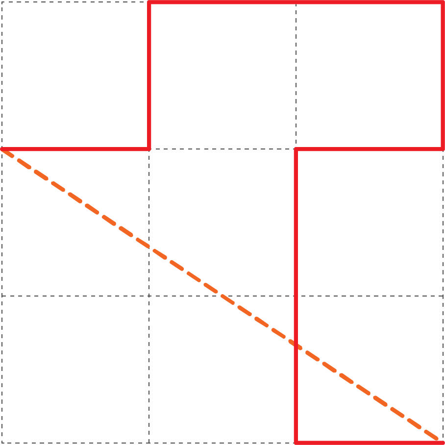
Through observation, it is clear that in the Daping pedestrian unit area, arterial roads have the highest level of connectivity and coherence. Following them are collector roads. Branches roads have the connectivity with a high degree of fragmentation. The pedestrian network is divided into isolated sections between arterial and collector streets.
Methodology
Efficiency – Choice analysis
From the perspective of network morphology, there are three crucial factors that influence pedestrian behavior the most: walking distance, the form of the path and intersections. This study constructs a quantitative analysis model for the efficiency and choice of the pedestrian network morphology, which will be referred to as “EC model” in the following content.
The network formed by one straight line connecting the origin and the destination has the highest efficiency. The individual pedestrian behavior in the public space network could be represented as the choices of directions made on the several intersections along the walking route. In this way, the walking route could be represented as a walking path that consists of a series of intersections and the paths between this intersection, then the efficiency of the network can be represented in the form of the network itself, usually measured by time and the distance of the route.
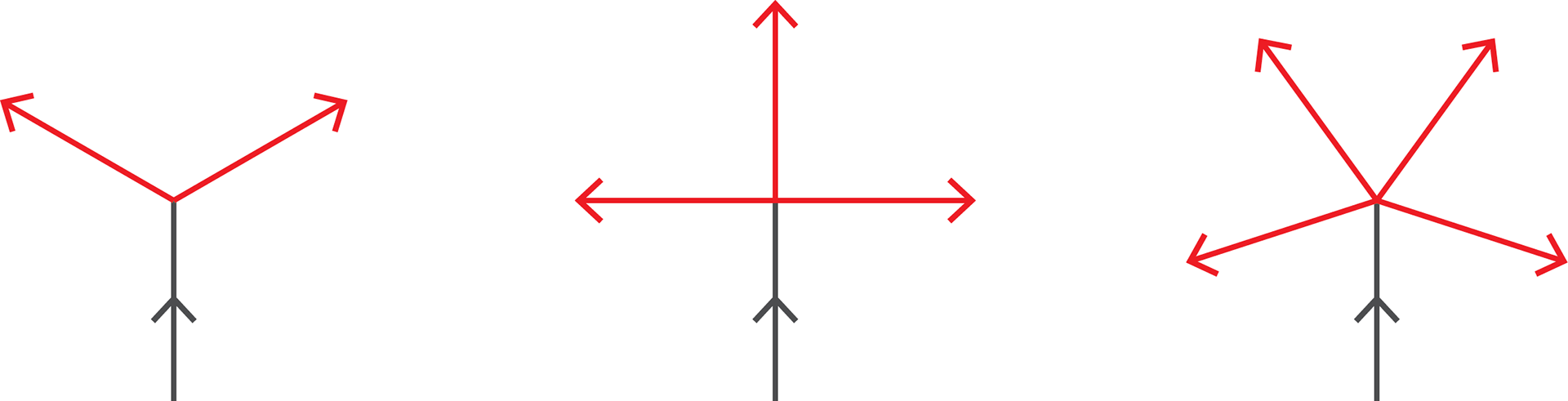
The walking route is separated at intersections, which means there would be the variety of alternative routes from each origin to each destination when there is enough amount of intersections. The specified duty of intersections should be to provide choices. “Multiple choices” has always been one of the fundamental aspects of the fascination of urban life, and the intersections are the “choice device” for the pedestrians walking in the network.
efficiency of walking route
Pedestrian efficiency is inflected in time through distance.

ld represents the geodetic distance from the origin to the destination, l stands for the route distance, 0<e<1.
The average efficiency of the pedestrian behavior from one point as the origin to any other points as the destinations should be calculated through the formula as follows:
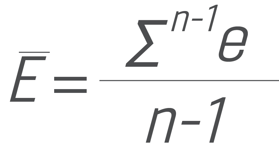
e represents the linear efficiency, n represents the amount of the intersections.
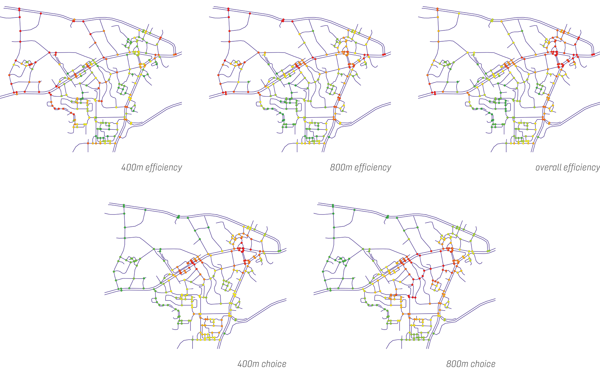
In this study, the efficiency value measured is the average efficiency from each origin in the radius of 400m and 800m, respectively represented with Ē400 and Ē800; and the overall average efficiency, represented with Ē.
choice of intersections
The choice value of each intersection equals the sum of all the choices of directions:

xi represents the amount of each kind of intersections in the studied area; i represents the number of streets connected to each kind of intersections.
In this study, the choice value measured is the choice of each origin in the radius of 400m and 800m, respectively represented with C400 and C800.
Results
On the GIS platform, the efficiency, choice and average distance between each point and all the other points among the 237 intersections in the sampled area are calculated and visualized to aid with further analysis of the network morphology. Based on the data acquired through investigations, the distribution of efficiency and choice, and the interaction between efficiency and choice are analyzed. Furthermore, the relations between the attributes of the network and actual urban life are also taken into consideration.
Conclusion
Feasibility
Based on this investigation and analysis, the EC model is feasible and practical for analyzing the morphological regulations of pedestrian networks. If integrated with other analytical and calculation methods such as space syntax, accessibility, and connectivity of pedestrian networks, and choice of walking routes, regular patterns and characteristics of pedestrian networks may be further discovered and better comprehended.
Complicated relationship between the efficiency and choice
As the Daping pedestrian network reflects, the complicated relations between efficiency and choice are not merely mutually beneficial or contradictory, but complicated and vague, which is highly relevant to the form of the pedestrian network itself.
Based on this study, the efficiency of the network is significantly affected by the line shape of the paths and the intersections. Efficiency is increased when the line shapes are straighter, and there are fewer intersections (which bears on the settings of the calculation—the calculation method does not take the distribution of the intersections into account), reflecting that efficiency tends to increase where there are better connectivity and continuity. The choice is highly relevant to the distance between intersections, their density, and their forms. The choice is improved when the distances between intersections are shorter, the intersections have more branches, and the area has a higher density of intersections. In conclusion, the pedestrian network should develop its morphological design according to pedestrian behavioral characteristics, rather than completely following the network for mobile transportation. Specific measures should be taken such as, not avoiding intersections with more branches, creating streets or paths for pedestrians only; developing more streets with higher density and narrower width; partially opening gated communities to pedestrian activity; and better connecting cul-de-sacs to the pedestrian network through pedestrian-only paths.
Further studies and empirical cases on the correlation between the efficiency and the choice of the pedestrian network are needed to analyze the balance of the two attributes under different circumstances for pedestrians.
Analysis combined with other attributes
Further studies should take into account the interactions between the form of street network and other attributes, such as pedestrian flows, urban functions, land use, commercial scale, quality of the pedestrian environment, and distribution of the leisure facilities. The mutual influences of the pedestrian network and other factors in the complicated mega-system of the city should also be further researched.